France is home to more than 60,000 kilometres of marked hiking trails. Between the GR (the Grande Randonnée) and lesser trails, here are some ideas for hikes with your partner or friends where you can discover some of the most beautiful places in France!
Book a train ticket
Book a train ticket
In order to best enjoy these hikes, take careful note of their level of difficulty. Most of them take multiple days, so you will need to find lodging or campsites in advance. Contact local tourism offices for more information! And don’t forget to bring good walking shoes, a map, a compass and plenty of food and water.

The best hikes in France
- The Vallée de la Bièvre, 15 km from Paris
- The Grande Traversée du Vercors (on the GR®91)
- The Sentier des Douaniers (GR®223)
- On the Way of Saint James, via the GR®65
- The Tour de Brocéliande
- Marseilles-Cassis on the GR®38
- The Sentier des Hirschsteine
- The Chemin de Stevenson (GR®70)
- The Circuit des Bastides

The Vallée de la Bièvre, 15 km from Paris
This is perfect for Parisians in need of a nature fix! From the Gare d’Austerlitz (where the Bièvre River begins), walk down to the small garden of the Petit Ceinture in the 13th, then head towards Arcueil Cachan and follow the river to its mouth in Saint-Quentin-en-Yvelines. The best part? When the sounds of the city fade away as you reach the thick Verrières State Forest.
Distance: 46 kilometres. 2+ days.
Level: Easy
The Grande Traversée du Vercors (on the GR®91)
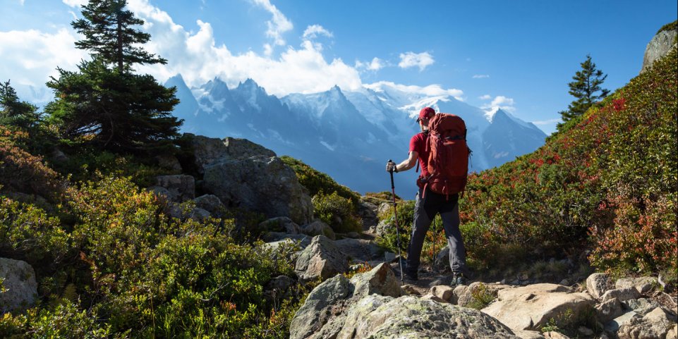
This is more than just a hike, it’s an introduction to a whole new world. Start in Corrençon-en-Vercors before heading to Châtillon-en-Diois in the Drôme, crossing one of France’s largest nature reserves. There you will discover soaring plateaus and breathtaking panoramic views of the Alps (especially from the Crêtes de la Molière, between Autrans and Lans-en-Vercors)!
Distance: 60 kilometres.
Level: Medium. 3+ days’ walking.
Take an SNCF bus from the Grenoble train station to Villard-de-Lans/Corrençon.
The Sentier des Douaniers (GR®223)
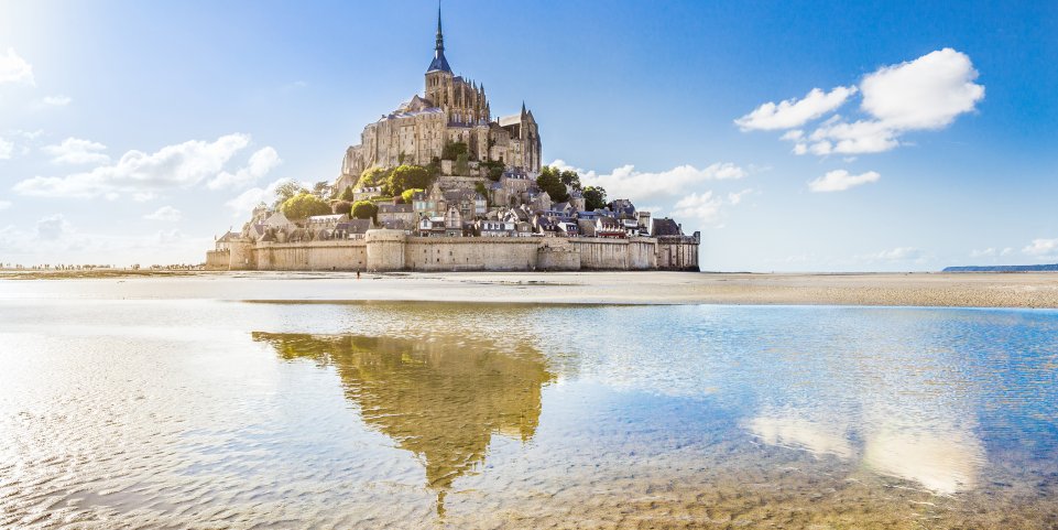
From Carentain in the Baie des Veys, to Mont-Saint-Michel, you will walk along the entire coastline of the department of La Manche. On the agenda: villages with stone houses, wooded trails, the sea and of course, Mont-Saint-Michel, which needs no introduction. A lesser-known but just-as-impressive site is the Nez de Jobourg. This cape is characterised by towering 128 metre high cliffs that melt into the turquoise sea.
Distance: 446 kilometres.
Level: Easy. Plan for 25+ days’ walking.
Travel to Carentan on an Intercité train from the Paris Saint-Lazare train station or a TER train from the Caen train station.
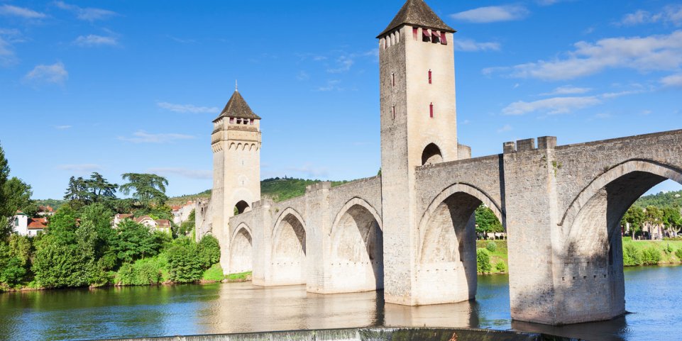
On the Way of Saint James, via the GR®65
This section of the GR®65 – between Figeac and Moissac – in the direction of Santiago de Compostela is particularly worth the detour: Partly because it criss-crosses the Quercy Regional Nature Park, but also because it wends its way through charming medieval villages. In Cahors, don’t miss the Wednesday morning market! The local truffles, wine and goat cheese will blow you away.
Distance: 160 kilometres.
Level: Medium. Plan for 9+ days’ walking.
Take a TER train from the Toulouse station to Figeac.

The Tour de Brocéliande
If you grew up with the stories of King Arthur, Merlin, and the Lady of the Lake (or just watched the series Kaamelot on TV), you will undoubtedly know about the forest of Brocéliande! This loop, which starts at Paimpont, is an original blend of legend and reality. Along the way, you will find the Fountain of Youth, near the Marette quarry, the golden tree and Merlin’s tomb. It’s magical!
Distance: 142 kilometres.
Level: Easy. Plan for 8+ days’ walking.
Take a bus (line 1A) from the Rennes bus depot to Paimpont.
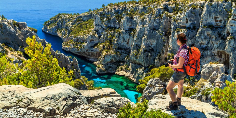
Marseilles-Cassis on the GR®38
This is a classic hike, as traditional as a bouillabaisse in the Old Port. Start at the beginning of the Calanques and continue on to Cassis, at the foot of the Soubeyrannes cliffs along the shore of the Mediterranean. It’s a perfect occasion for newcomers to the region to discover the rocky inlets of Marseilleveyre and the old fishing villages, such as Morgiou. Be warned: this hike includes a lot of elevation change.
Distance: 30 kilometres.
Level: Difficult. Plan for 2+ days’ walking.

The Sentier des Hirschsteine
Starting at the parking lot of the Col de la Schlucht, you will head to Lac Vert, in the heart of the Vosges forest. This is a particularly hilly and difficult hike, with steep slopes and passages carved directly into the mountain— so be very careful! The hidden reward for your efforts is the Hirschsteine lookout point at the summit, which offers an unobstructed view of the dense forest.
Distance: 7 kilometres.
Level: Difficult. Plan for one day’s walking.
Accessible only by car.
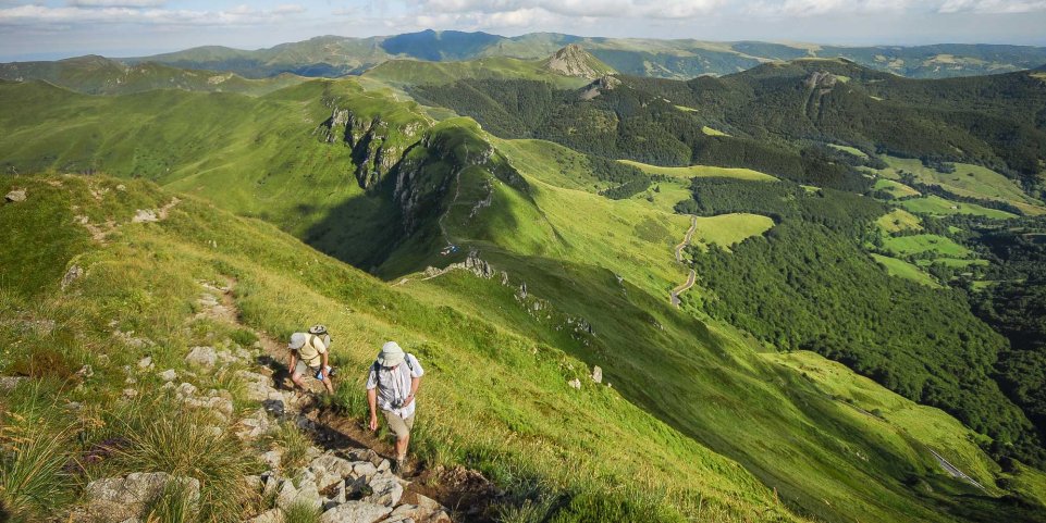
The Chemin de Stevenson (GR®70)
This hike gets its name from the trip Scottish writer Robert Louis Stevenson (author of Treasure Island) took from Puy-en-Velay in the Auvergne region to Alès in the Gard. Along this long walk, you will see a wide range of landscapes, from the volcanoes of the Auvergne region to the Cévennes Nature Park.
Our advice: go in May or June, when the ground is covered in magnificent flowers!
Distance: 274 kilometres.
Level: Medium. Plan for 15+ days’ walking.
Take an SNCF bus to Puy-en-Velay from Clermont-Ferrand or Saint-Etienne.

The Circuit des Bastides
The “bastides” are little Occitan villages founded in the 13th and 14th centuries. This very accessible circuit lets you visit the three largest cities in the Périgord, starting from Sarlat. After crossing Molières, Beaumont and Monpazier, take a well-deserved break in Villefranche-du-Périgord: not only for the beautiful architecture, but also for the delicious lunch at La Bastide, a local favourite.
Distance: 120 kilometres.
Level: Easy. Plan for 8+ days’ walking.
Take a TER train to Sarlat from the Bordeaux Saint-Jean train station.